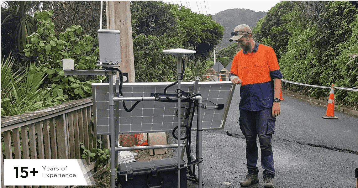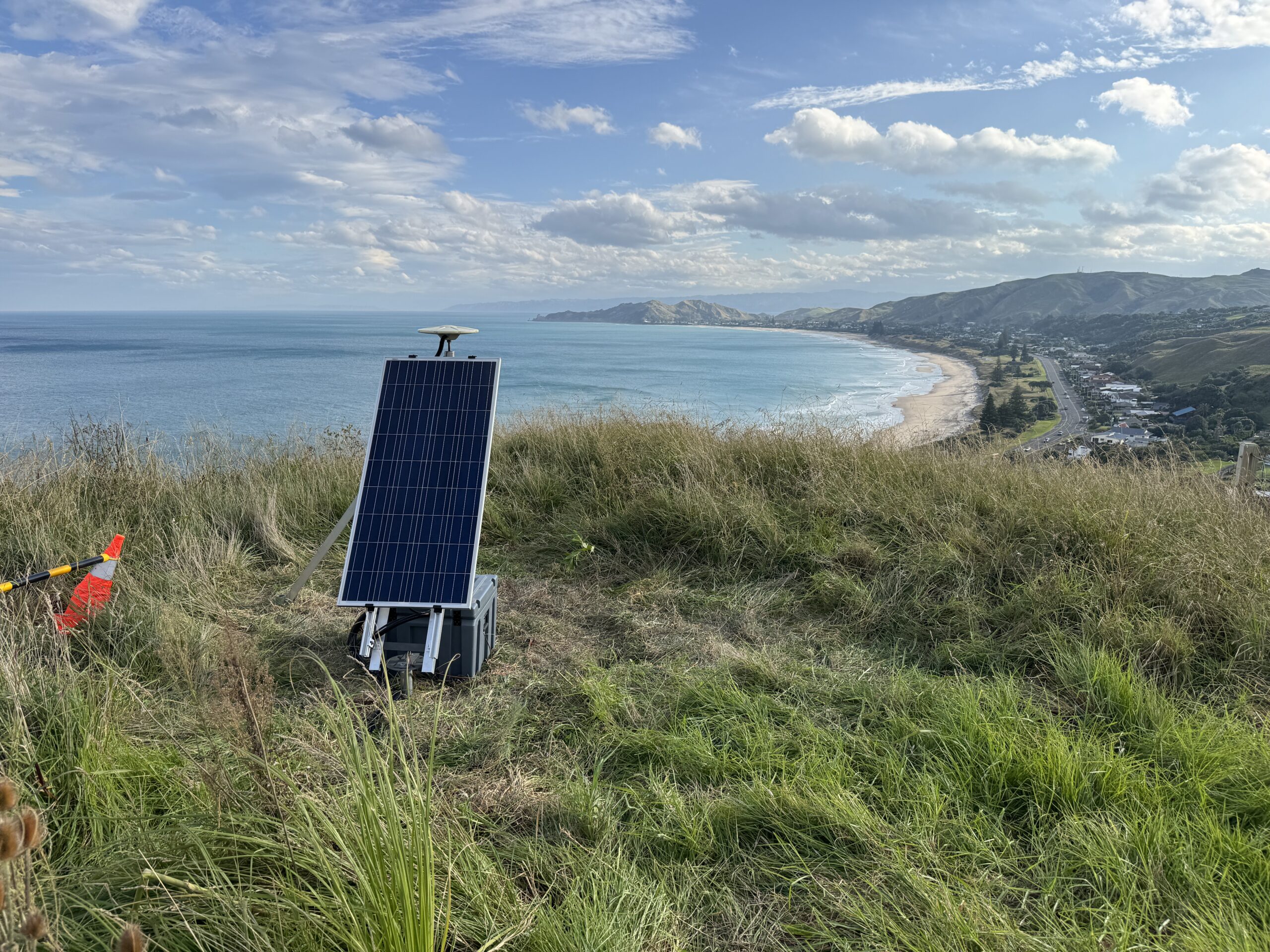
Landslide monitoring installation at the Makorori Headlands walking track in collaboration with Gisborne District Council (GDC) and Earth Sciences New Zealand (ESNZ). We deployed precision GNSS and seismic sensors to track ground movement, allowing Gisborne District Council to make data-driven decisions and keep the track open and safe for the community.
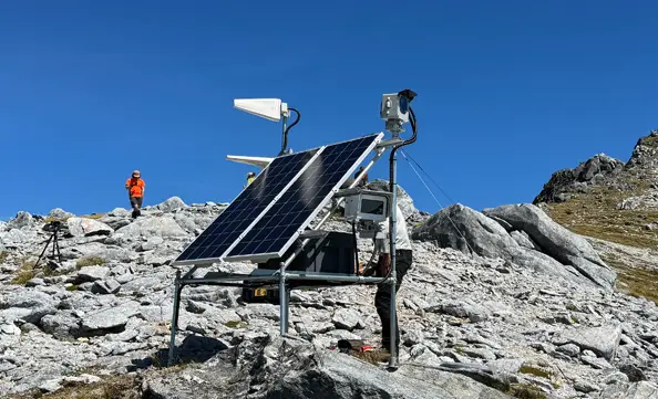
Successful installation of advanced camera systems in the challenging and remote alpine regions of Fiordland. This installation supports Envirolapse Pty Ltd in their environmental monitoring efforts, providing high-quality imagery and data to the Department of Conservation from one of the most rugged and inaccessible areas in New Zealand.

Upgrade and reference mark survey of GNSS Continuously Operating Reference Stations (CORS) for the LINZ positioning network. This project enhanced the accuracy and reliability of the LINZ positioning network, crucial for a wide range of applications including land surveying, construction, and geospatial research.

Installation of a satellite interface for GeoNet to ensure reliable data transmission for scientific research and monitoring of geological hazards. GeoNet operates a comprehensive network of over 1000 monitoring instruments across New Zealand, providing 24/7 data collection and analysis for earthquakes, volcanic activity, landslides, and tsunamis. This upgrade provides uninterrupted connectivity and data flow essential for remote monitoring and real time analysis.
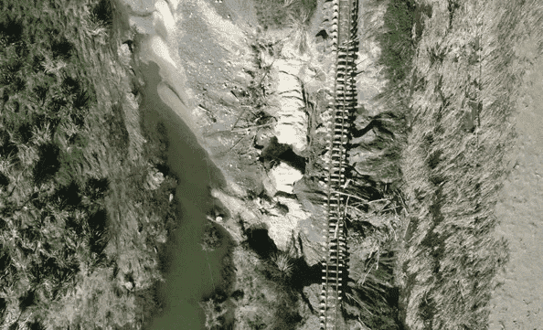
Survey to assess damage to the railway line caused by Cyclone Gabrielle and create a digital terrain model (DTM) and orthophoto for engineers to plan and rebuild. This project was crucial for KiwiRail, whose network was heavily impacted by the cyclone, particularly the Palmerston North to Gisborne Line. The survey allowed for a more in-depth damage assessment, identification of high-risk sites, and provided a detailed DTM, enabling engineers to effectively plan and rebuild. The data collected was helpful for the restoration of the rail network, ensuring the continuation of vital rail freight services to Napier Port and contributing significantly to the region's recovery efforts.
We deliver precision GNSS positioning and monitoring systems across New Zealand. RTK base stations, NTRIP correction services, Atlas-Delta landslide monitoring, and field deployments in remote and challenging locations.
Whether it’s alpine monitoring, post-disaster assessment, or ongoing positioning networks, we deliver proven expertise and local knowledge.